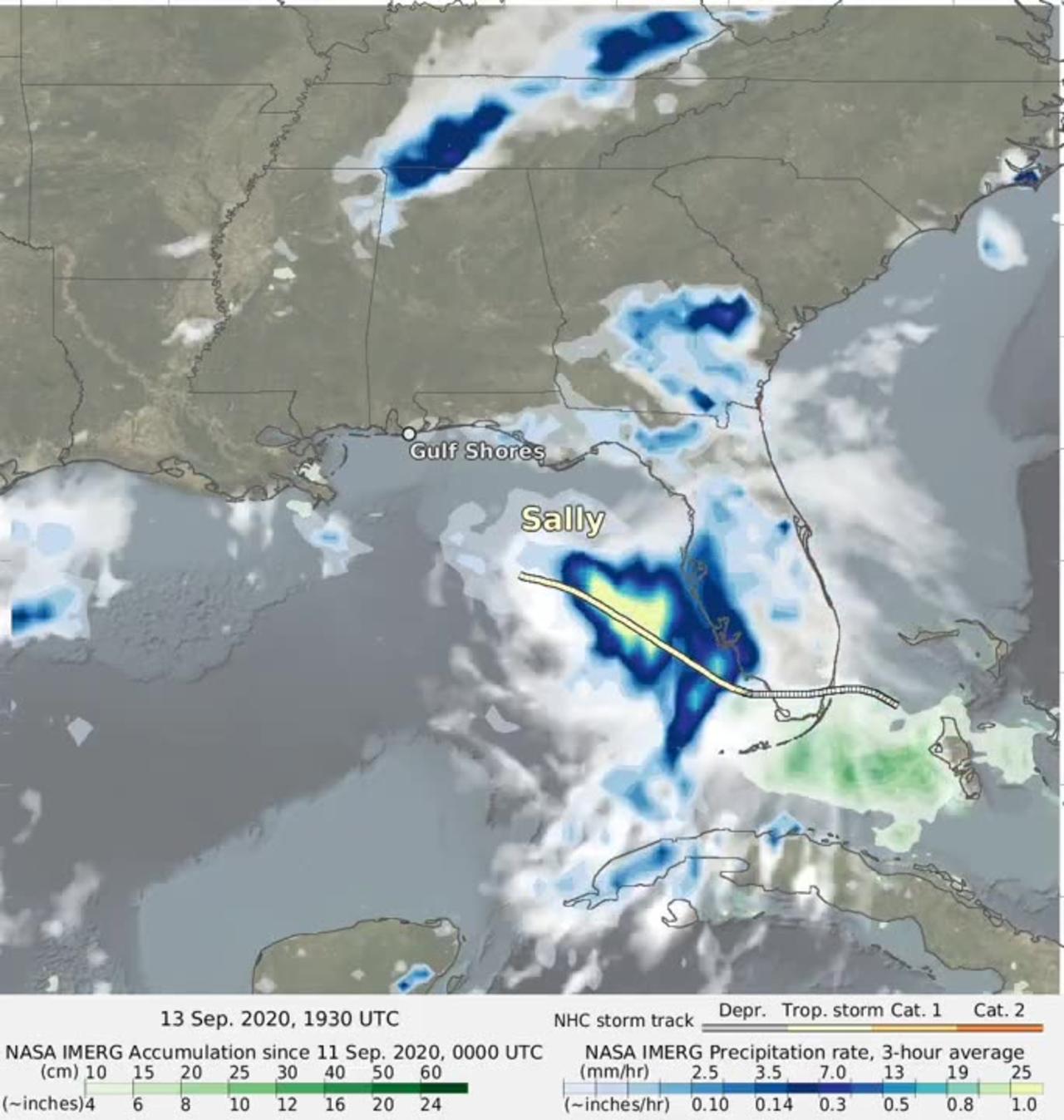
NASA IMERG combined data from multiple satellites to estimate the rainfall from Hurricane Sally in near-real time at half-hourly intervals from September 11 to 16, 2020.
This animation shows rainfall rates (blue/yellow shading) and rainfall accumulations (green shading) from NASA's IMERG algorithm, overlaid on shades of white/gray cloud data from NOAA infrared satellite instruments.
The multi-colored line shows Sally's track based on National Hurricane Center advisories, with orange indicating hurricane strength winds.
Credit: NASA/Jason West